- calendar_today June 10, 2026
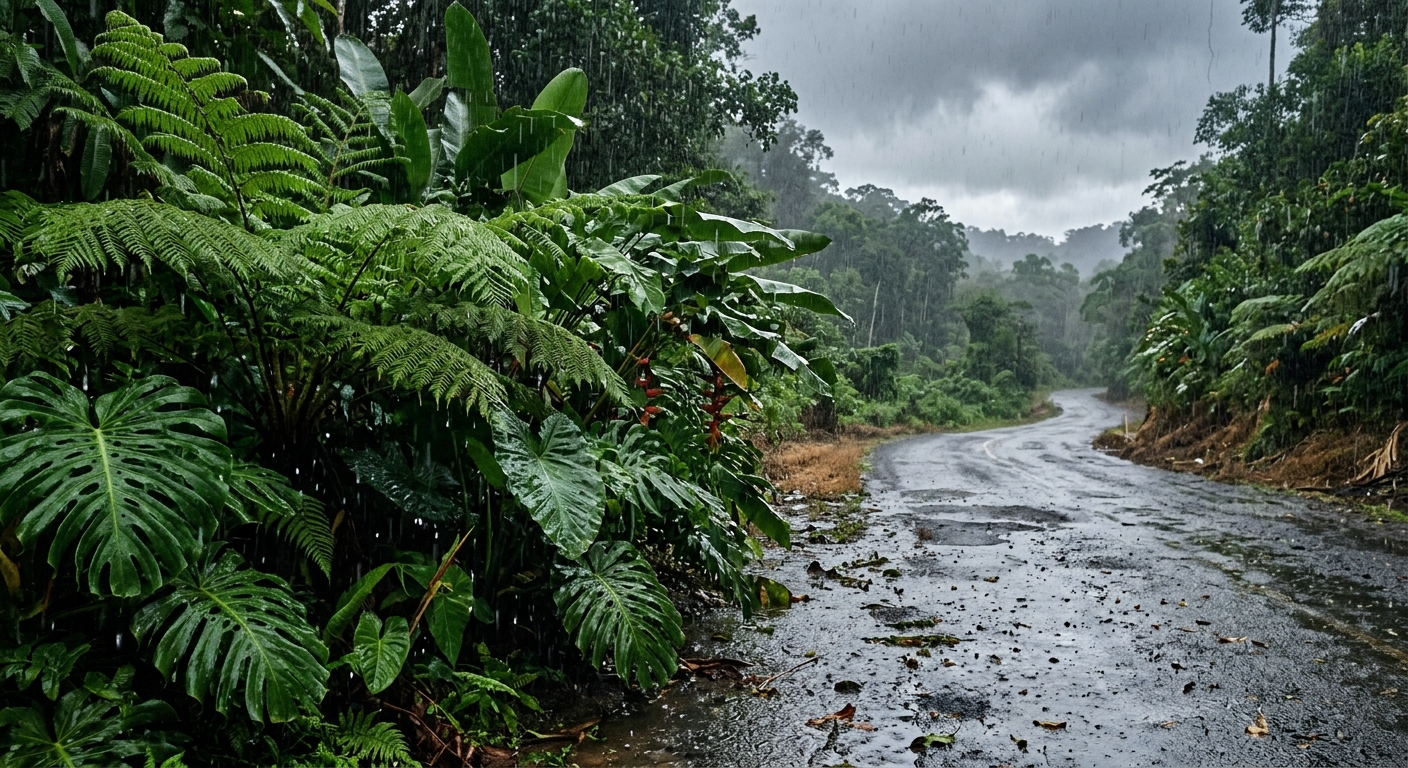
Hawaii & Pacific: East Hawaii rainfall has surged well above seasonal expectations this June, intensifying conversations about local weather patterns as the region officially enters the dry season. According to data provided by the National Weather Service, Hilo International Airport recorded an impressive 4.13 inches of rain as of June 8—far surpassing the monthly average.
June Rainfall Exceeds Averages Across Windward Locations
Several windward communities on Hawaii Island are experiencing significantly higher June rainfall than usual. Stations at Laupahoehoe and Hakalau reported more than 12 inches of precipitation within the opening weeks of the month. At Hakalau, totals reached nearly five times its historical June average, underscoring the remarkable nature of this year’s early-summer deluge.
Understanding the Unusual Wet Start to the Dry Season
Hydrologists point to familiar explanations behind this weather. Tina Stall, a hydrologist with the National Weather Service, clarified that the transition into Hawaii’s dry season typically unfolds gradually. Rather than being tied to climate change or late spring’s Kona low storms, Stall attributes this surge in precipitation to classic trade wind weather patterns, which are currently delivering lanes of increased moisture across East Hawaii.
Hilo Airport Rainfall Highlights Regional Differences
The substantial Hilo airport rain figures exemplify broader trends along the windward coast. Meanwhile, the leeward Big Island—including the famed Kona coffee belt—remains notably dry. While these areas have not yet experienced similar increases in moisture, meteorologists caution that conditions could change later in the season.
Climate Patterns: El Nino and Its Implications
Looking ahead, experts are monitoring the development of El Nino, which historically boosts dry season rainfall and raises the possibility of more frequent tropical cyclones. Although El Nino conditions have not fully materialized as of early June, Hawaii & Pacific is trending toward this pattern, and forecasters are taking note of past years’ impacts on both rainfall and storm frequency.
Hurricane Season Outlook for the Central Pacific
The central pacific hurricane season began in earnest this month, with predictions pointing to an active year. Meteorologists anticipate between five and 13 tropical cyclones passing through the region, fueled in part by the evolving climate signals. This forecast serves as a critical reminder for residents and businesses to prepare for the threat of severe weather through the summer and fall.
Kona Coffee Belt: Summer Prospects for Growers
While windward areas have seen exceptional rainfall, the Kona coffee belt and other leeward big island farming communities have thus far experienced a dry start to the summer. Forecast specialists note that it remains unclear whether growers will see above-average summer rainfall; however, there is currently no indication of a significant shortfall that would jeopardize crops.
Drought Conditions Delayed by Recent Rains
Benefits from the early June rainfall event extend beyond agriculture. The heavy precipitation has staved off the onset of drought conditions, likely postponing the risk of water stress until at least winter. Hydrologists and forecasters will continue to monitor rainfall trends closely as the dry season progresses, keeping both local communities and industries informed.
East Hawaii Rainfall in Regional Context
This notable stretch of wet weather offers a reminder of Hawaii & Pacific’s complex climate systems. As east Hawaii rainfall remains well ahead of typical June measurements, local agencies emphasize the importance of community preparedness for sudden weather shifts. From supporting the Kona coffee belt’s agricultural productivity to managing the risks posed by tropical cyclones, regional stakeholders are keeping a close watch on rain gauges and forecasts alike.